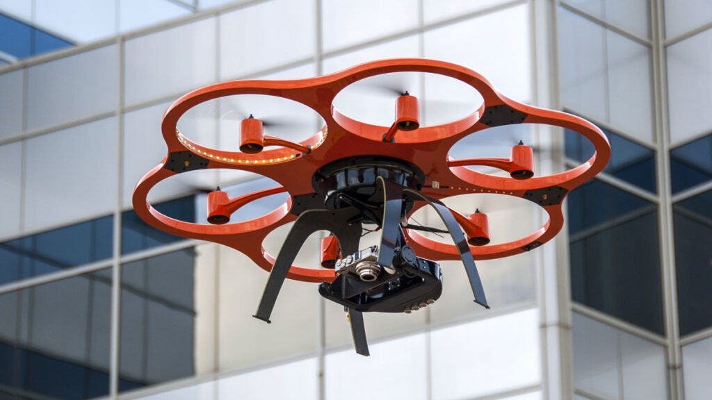
Laser Scanning (LiDAR)
Laser scanning enables detailed terrain analysis and measurement of 3D coordinates based on laser signal returns.

Laser scanning enables a detailed terrain analysis and measurement of 3D coordinates based on laser signal returns. LiDAR is the best choice for densely vegetated areas, since the LiDAR signal has the ability to penetrate through dense vegetation in multiple ways, and it provides the highest quality method for creating a digital terrain model (DTM).
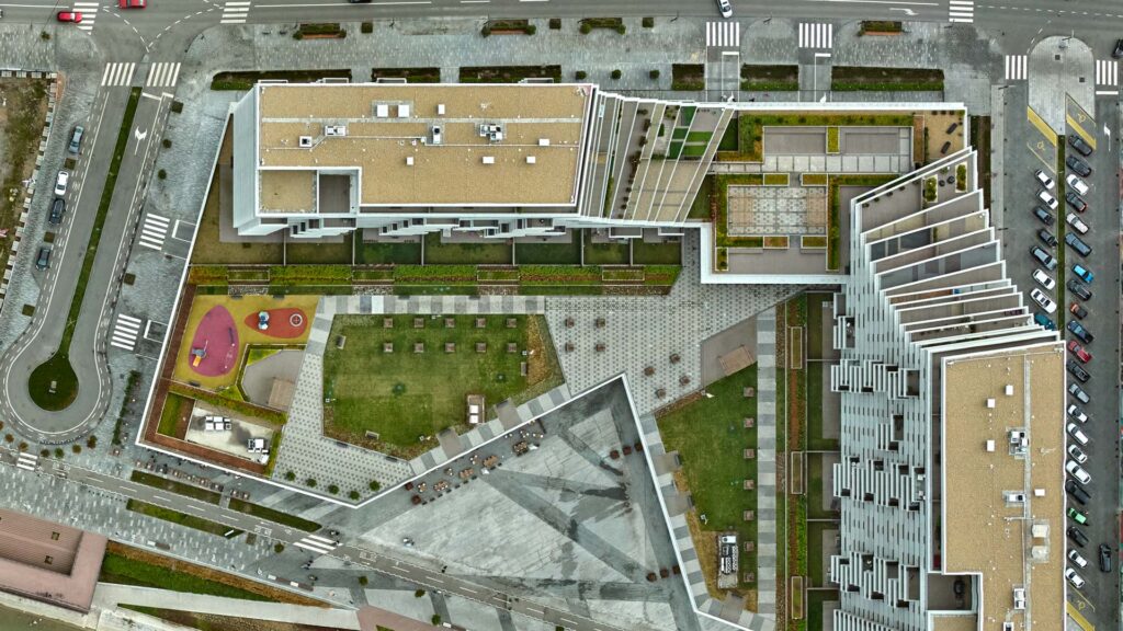
Unlike vertical images, an orthophoto is the representation of an orthogonal projection. It is created by vertical image processing. Additionally, the TOP GEO Company is able to produce orthophoto maps either for cities or entire countries.
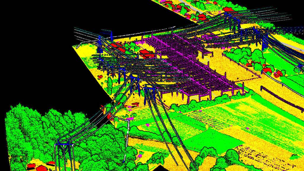
The TOP GEO Company provides low voltage and high voltage power line mapping services using the LiDAR scanning system. The results obtained from the laser scanner are further processed using various software packages and used for both the inspection and reconstruction of existing power lines and the design of new ones.
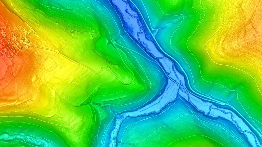
Digital Terrain Model (DTM) is generated from laser scanning data. It is a 3D representation of the bear-earth terrain – it does not include objects on the ground either man-made like buildings or natural like vegetation. On the other hand, the Digital Surface Model (DSM) depicts both the natural and built features of the terrain such as buildings and vegetation.
The true orthophoto differs from a standard orthophoto in that the objects do not incline i.e. they are all vertical. Shadows and blind spots caused by the camera angle are, thus, maximally eliminated. True orthophoto is the best choice for urban areas.
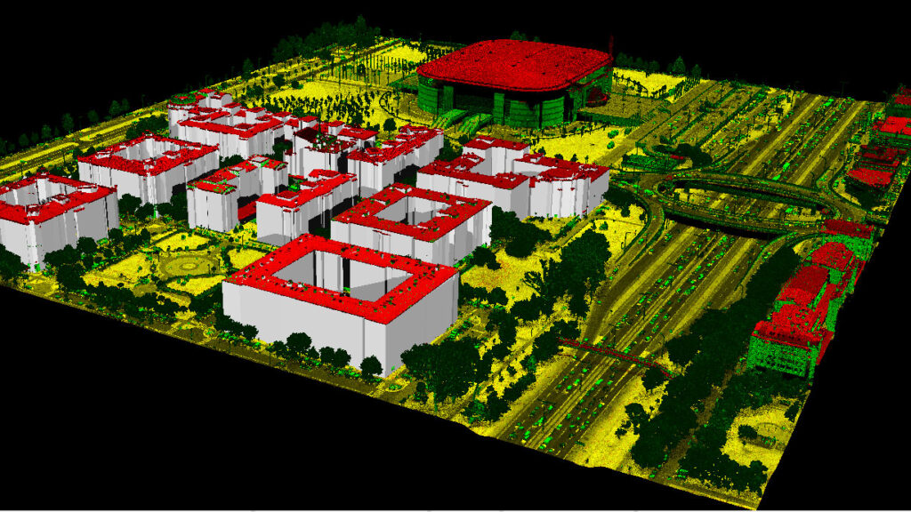
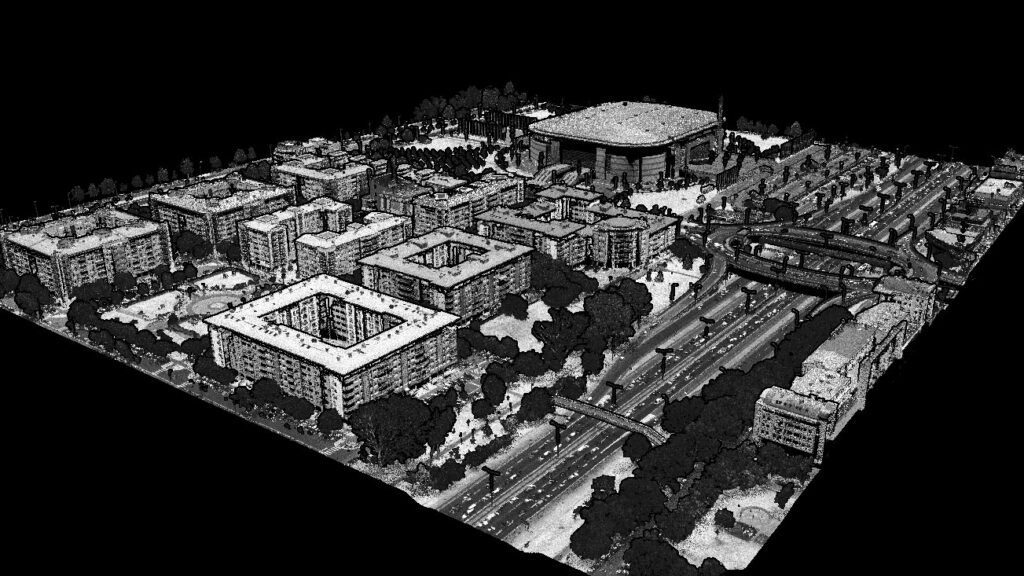
3D models are an essential part of urban planning. The TOP GEO team can process their vertical aerial images and data generated from LIDAR scanning and present in the form of 3D models according to the requirements of our customers.
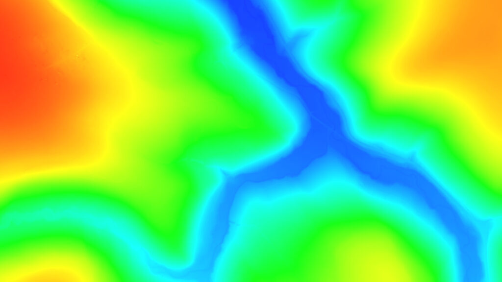
Based on floodplain analyses, we can detect significant changes on the terrain surface and produce flood risk assessments. By comparing archival images of a particular area, this natural hazard can be precisely predicted, and necessary actions taken to prevent or reduce such a risk.
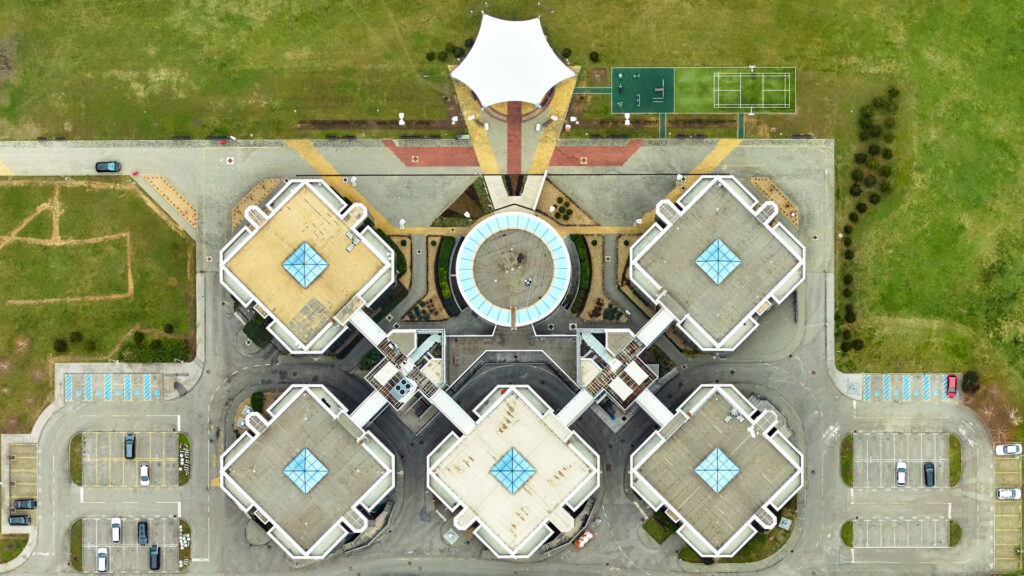
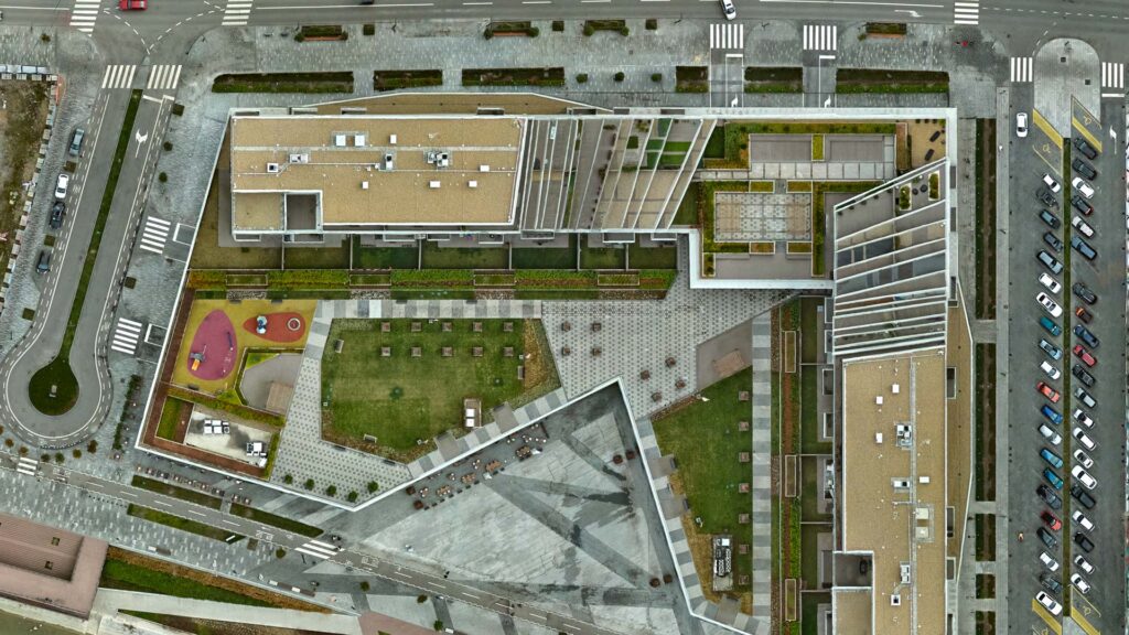
Thanks to high-resolution digital cameras, we can produce detailed vertical aerial images with the spatial resolution and processing technology for our clients according to their needs.
As far as smaller projects are concerned, we perform aerial survey using unmanned aerial vehicles, which gives us an orthophoto and a digital surface model (DSM) as the final products.
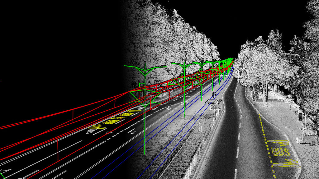
Our Riegl VP-1 system with Vux-1LR scanner can be attached to a various types of vehicles to collect data from both streets and railways. Our mobile mapping system collects 750,000 points per second with the centimeter level mapping accuracy.
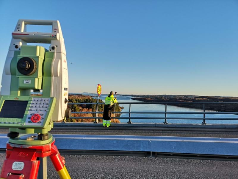
The TOP GEO Company performs all types of terrestrial geodetic measurements for designing and establishing basic geodetic plans for the purpose of construction work performance. An integral part of services we offer and provide to our clients pro bono are consulting services which involve seeking the best possible solutions to technical and procedural unknowns.