Skip to content
TOP GEOTOP GEO
  • Home
  • About Us
  • Technology
  • Services
  • Blog
  • Contact
  • SRBSRB

Blog


Airborne LIDAR scanning and mapping of the high-voltage power lines on the territory of the Republic of Serbia has been done

Our team has successfully performed the aerial survey (aerial imagery and LIDAR scanning) and mapping [...]

06
May
Airborne LIDAR scanning has been done in the Federal State of Baden-Württemberg – Germany

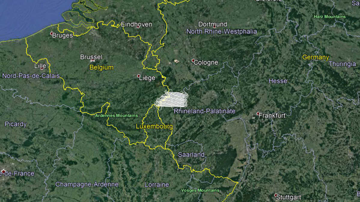
In this flying season, our team has successfully performed the aerial survey (LIDAR scanning) of [...]

28
Apr
Airborne LIDAR scanning has been done in the Federal State of Rheinland-Pfalz – Germany

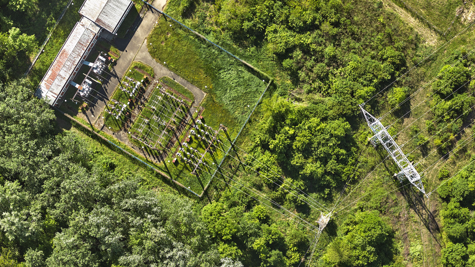
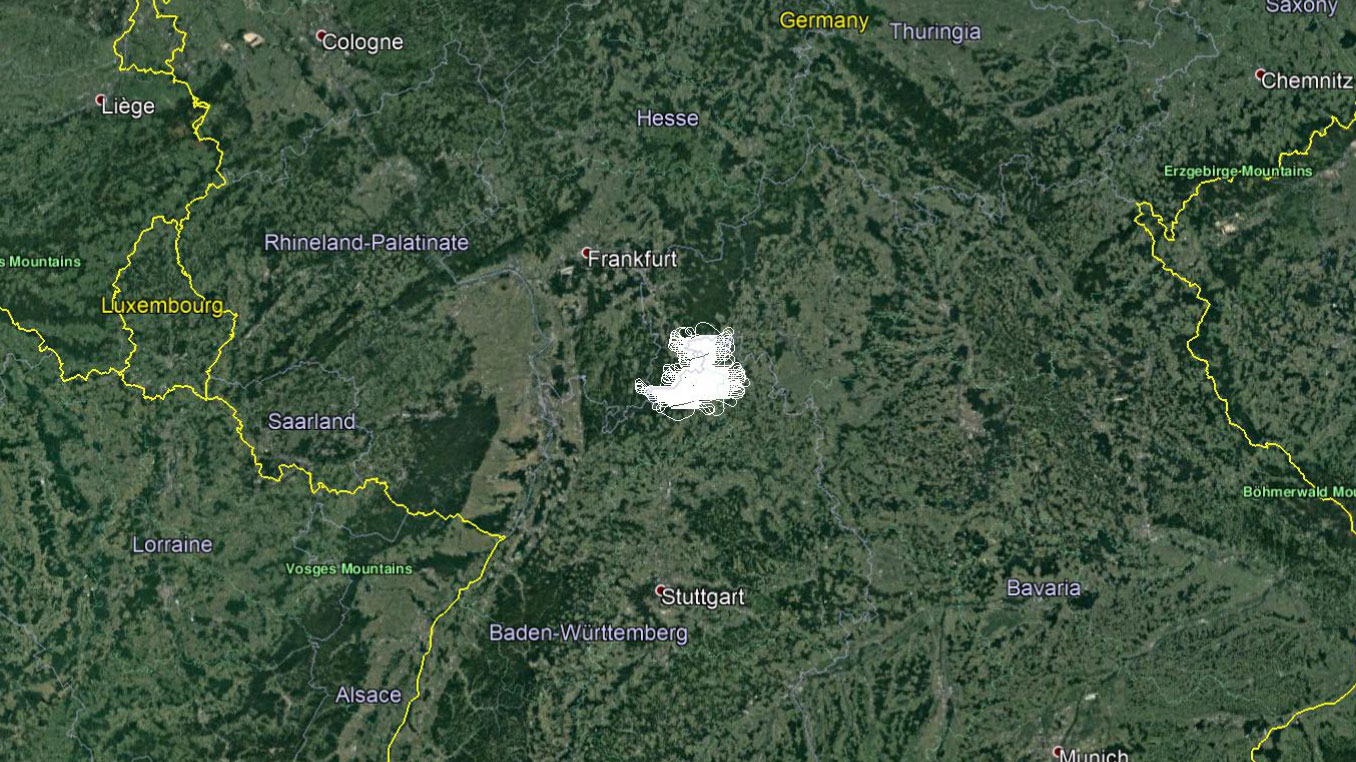
Our team has successfully performed the aerial survey (LIDAR scanning) in the Federal State of [...]

31
Mar
Aerial survey and LIDAR scanning of Belgrade has been done

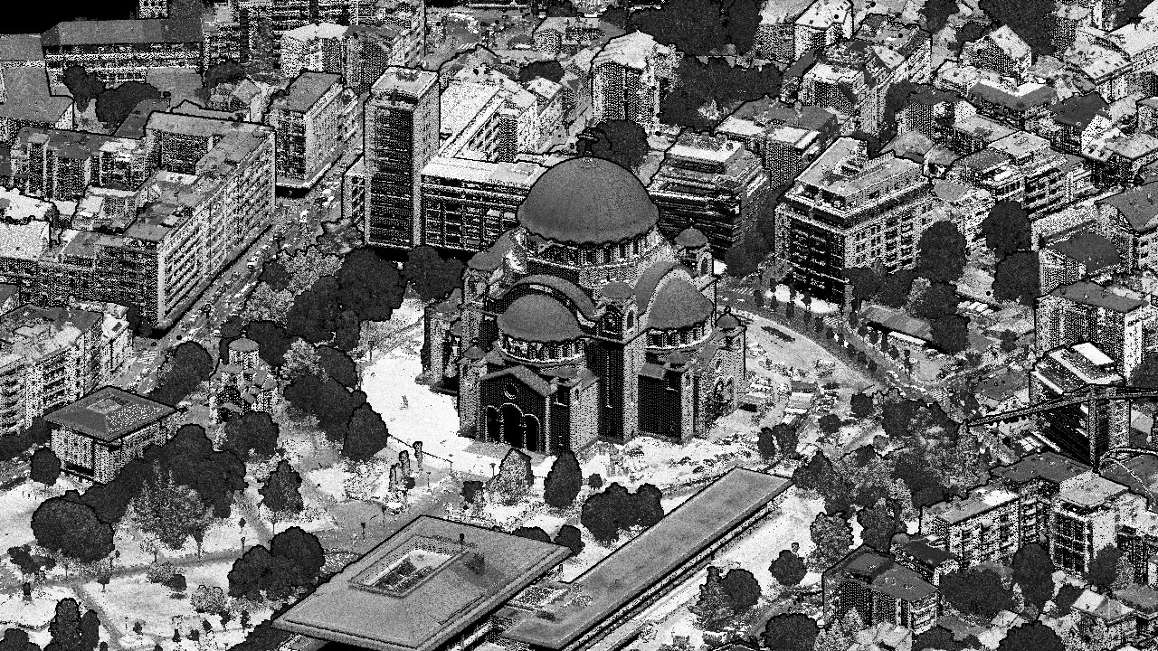
Our team has successfully performed the aerial survey (aerial imagery and LIDAR scanning) of the [...]

07
Mar
Latest articles
  • Airborne LIDAR scanning and mapping of the high-voltage power lines on the territory of the Republic of Serbia has been done
  • Airborne LIDAR scanning has been done in the Federal State of Baden-Württemberg – Germany
  • Airborne LIDAR scanning has been done in the Federal State of Rheinland-Pfalz – Germany
Designed by Graphic Beast
Copyright 2023 © TOP GEO d.o.o.
  • Home
  • About Us
  • Technology
  • Services
  • Blog
  • Contact
  • SRBSRB